Summary:
Earth Zoom is a simple program that serves as a demonstrator for my concept of relative detail
in a large scale environment.
The gist is that, starting in outer space, as the camera zooms in towards UC Santa Cruz more
and more detail will gradually be added and at any given point in the zoom, only as much detail as is
needed will be rendered to preserve efficiency, aesthetics, and a smooth transition.
The full program can be found below, just click on the link.
User Guide:
The program is simple enough to use.
Zoom in: "w"
Zoom out: "s"
Please make sure the caps lock is disengaged otherwise the controls will not work.
The browser window is resizeable without making any change to the program.
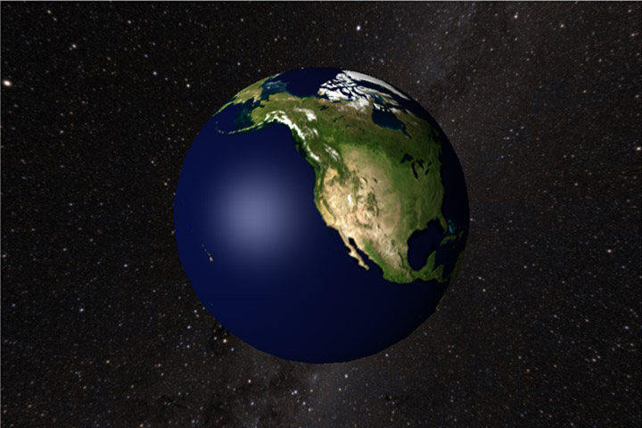
Out in orbit. Roughly 6000 mi. from the Earth's surface.

About 750 mi. above the Earth's surface. Bump texturing of terrain and higher resolution texture.

About 90 mi. above the surface. You can see San Francisco Bay and Monterey Bay.

The UCSC campus comes into focus here at a little more than 2 mi. above the surface.

Once we're about 320 ft. above Science Hill it transitions to a crude 3D representation.
In an ideal world the trees
and buildings would have been textured with the portion of the
satellite image beneath them, but we can use our
imaginations for now.